 From its source in the compacted annual snows in the high peaks of Yosemite National Park, the Tuolumne River runs a long and varied course on its path to where it joins the San Joaquin in California’s Central Valley. On the way it tumbles through a remote and truly wild section of unique beauty.
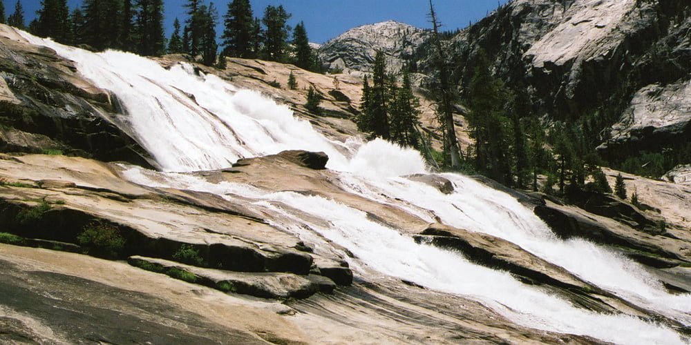
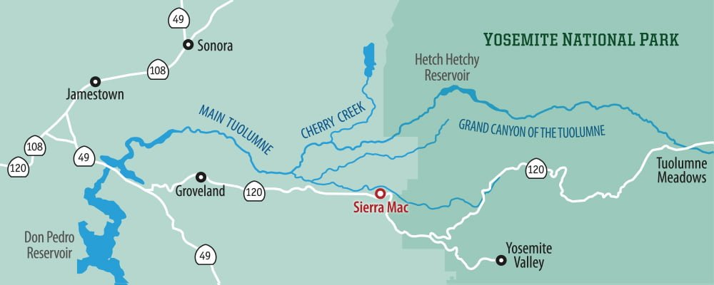
The headwaters of the Tuolumne begin on the Lyell and Dana Forks located in Yosemite’s high country. These two forks eventually meet at the eastern end of Tuolumne Meadows and then flow calmly for a stretch before continuing their journey to the lower elevations. After passing gently through the Meadows, the river begins descending gradually in elevation, first through a scenic canyon, culminating in the White Cascade located at Glen Aulin. Here the river increases its descent through a stunning series of waterfalls, pools, and rocky channels as it passes into the Grand Canyon of the Tuolumne.
A backpacking trail follows along this section of river with trail heads accessing the canyon at Tuolumne Meadows and White Wolf Campground on the Canyon’s south rim. In the winter this trail is inaccessible, but as the weather warms the canyon provides one of Yosemite’s quintessential backpacking trips. Most backpackers begin this 33 mile, multi-day hike at White Wolf, descending approximately 3,500 feet on step switchbacks to the river and then follow the river upstream back to Tuolumne Meadows.
Currently (July, 2018), the bridge crossing the river at Pate Valley is out-of-service, making this section of the trail impassable at spring and early summer water levels and requiring backpackers to make a shallow river crossing in summer and fall. If you plan to explore this area, consider beginning your trip at Tuolumne Meadows and camping at Glen Aulin or one of the downstream campsites and then using your campsite as a starting point for day hikes down into the Grand Canyon without the weight of a full backpack. A wilderness permit is required for camping here which can be acquired at the Wilderness permit station located in Tuolumne Meadows and other locations around the Park.
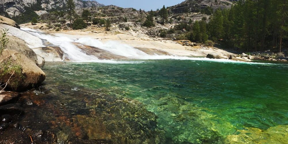
Backpacking into and out of the canyon is definitely a workout, but the payoff is more than worth the effort. Even in peak summer season, you can leave the crowds behind when you enter the backcountry. This upper section of the Tuolumne is punctuated by large and small waterfalls and numerous crystal clear swimming pools – a welcome respite in the sometimes intense heat of summer. Pristine wild trout fishing holes are also plentiful. Watching the wheels go round at Waterwheel Falls (above) is hypnotically satisfying. But watch your step because this trail is also known for an abundance of rattlesnakes.
Beyond the Tuolumne’s Grand Canyon, the river flows into and is temporarily impounded at Hetch Hetchy Reservoir. This stored water is gradually released over the summer, creating raftable flows downstream long after many other Sierra rivers have gone dry for the year. After shooting across the spillway below Hetch Hetchy, the river exits the Park and enters the Stanislaus National Forest, eventually reaching the confluence with Cherry Creek which enters from the north. Here the river begins another remote wild and scenic 27 mile section of oak and pine studded canyons, secluded sandy beaches, and exciting Class IV-V rapids most of which is accessible only by raft.
Class V Cherry Creek Upper T rafting trips begin on Cherry Creek two miles upstream from where the rivers meet, and continue for another thrilling seven miles of nearly non-stop rapids to just upstream of Lumsden Falls and Meral Pool. Here the river calms down a little. This is where we put in for our popular class IV-V Main Tuolumne rafting trips. Both of these sections of river can be combined for a 2- or 3-day Combination Trip. We invite you to explore the Tuolumne river for yourself. Call Marty or Tom to start planning your adventure at 209-591-8027.
Top photo: Creative Commons, additional photos and video by Brian Louks.
