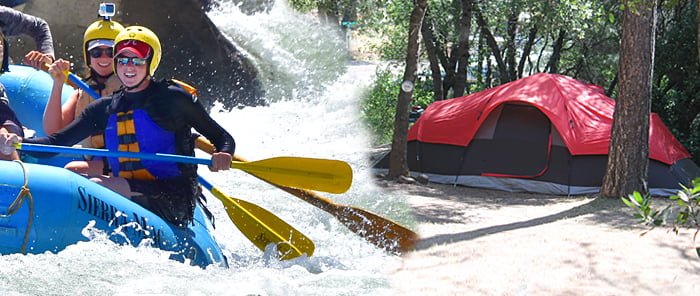
Tuolumne River Campground Guide
Where to Camp near our Main Tuolumne and Cherry Creek Rafting Trips
Many of our Main Tuolumne and Upper Tuolumne/Cherry Creek rafting guests ask about the location of campgrounds where they might stay before or after their trip. We now offer camping at our meeting location, please inquire! This article focuses on designated campgrounds located within 30 minutes of our meeting spots for these trips.
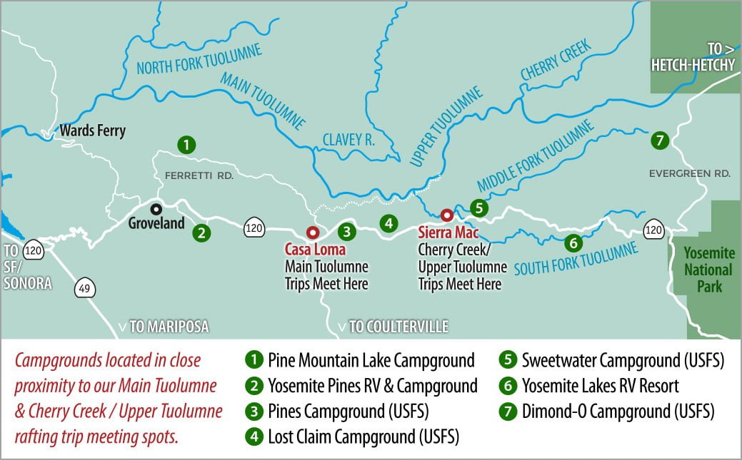
Sierra Mac’s Main Tuolumne River rafting trips meet at the Casa Loma Parking Area, 7 miles east of Groveland on Highway 120. Cherry Creek/Upper Tuolumne and Combination trips meet at Sierra Mac Headquarters, also located on Hwy 120, 13 miles east of Groveland. Both meeting spot locations border the Stanislaus National Forest.
Visitors arriving a day or two early will find a lot to explore in the immediate area. Nearby Rainbow Pool is a favorite with the locals and provides a great spot to cool off with a dip in its crystal clear waters. Located just outside the Yosemite Park entrance station, Evergreen Road leads to the trail head for Carlon Falls and eventually to the Park’s famous Hetch Hetchy Reservoir.
The 120 corridor between Groveland and Yosemite National Park’s Big Oak Flat Entrance offers several great choices for both RV and tent camping, but plan ahead – many sites get reserved early for the busy summer months.
Camping near Groveland
Pine Mountain Lake Campground has 33 RV sites and 11 tent sites. Traveling east on Hwy 120 towards Yosemite through Groveland, take a left turn on Ferretti Rd. Travel 3.5 miles then turn left on to Rocky Point Drive. Campground is located at 13500 Rocky Point Drive. RV sites are $37 per night; tent sites are $25. For reservations call (209)962-8615. More details on the PML Campground web page.
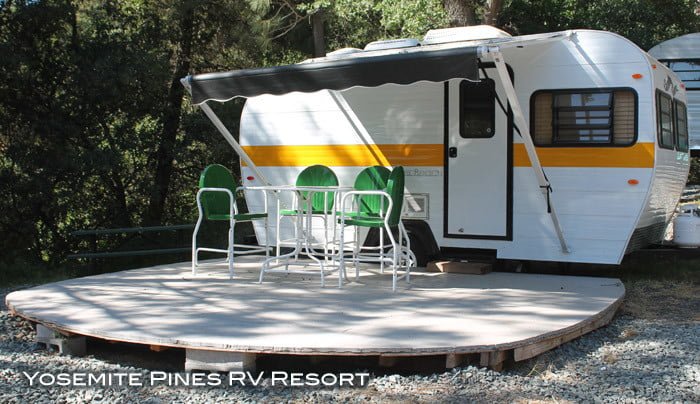
If you have an RV or would like a few more amenities consider Yosemite Pines RV Park & Campground where you’ll find traditional tent campsites as well as several other lodging options including cabins, yurts, as well as some classic retro trailers. Yosemite Lakes is a few miles east of Groveland on the Old Highway 120. For rates, availability and details visit their website.
If traditional camping a little closer to nature is more your style, there are several Stanislaus National Forest campgrounds located between Groveland and Yosemite National Park.
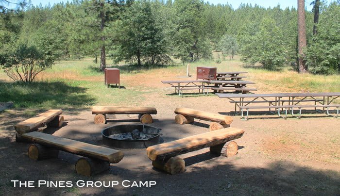
Looking for a campsite in the National Forest to reserve for a large rafting group? The Pines Campground, located approximately 9 miles east of Groveland off Hwy 120 has a group RV/tent campsite (no hookup) that can be reserved for up to 50 people. Price for this group site is just $90 per night. There are also 10 smaller first-come first-served sites adjacent to the group camp. Look for the Pines Campground sign on the right as you are headed east. More details on the Pines Group Site can be found online on the Pines Group reservations page.
Open from May to September of each year, the Lost Claim Campground is a rustic site located less than 10 minutes from both raft trip meeting spots. Located directly on Hwy 120 around 11 miles east of Groveland, Lost Claim Campground has 10 tent sites that are available by reservation only. online at: recreation.gov or by calling 1-877-444-6777.
Camping Closer to Yosemite
About 14 miles east of Groveland, The Sweetwater Campground is located less than a mile from Sierra Mac’s property. Sites here are all first-come first-served, but get here early, they go fast.
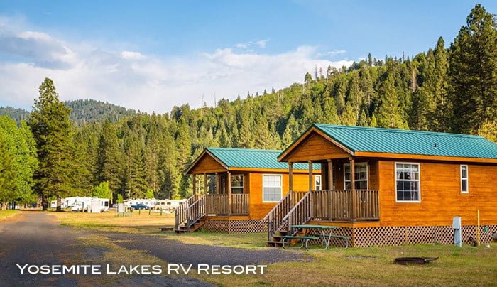
Camping not your cup of tea? Don’t feel like hauling all your camping gear? Need something soon? Yosemite Lakes RV Resort has over 200 RV sites in addition to several other lodging options. Choices include cottages, cabins, hostel style bunkhouses and yurts; all situated on their property located on the South Fork of the Tuolumne River. Located at a little higher elevation than Groveland, they are the largest RV site in the area and the facilities are excellent. More information at their website
Last but not least is the Dimond O campground on Evergreen Road. To get there follow Evergreen Road 8.5 miles from where it cuts off Highway 120 shortly before it reaches Yosemite’s Big Oak Flat Entrance station. Located at 4400 foot elevation, most of the Dimond O’s 38 campsites must be reserved (Recreation.gov), but they do keep a few sites open on a first-come, first served basis.
You can use this Google Map on your phone for driving directions to the various campgrounds in the area. Please note: the Google map indicates Lumsden and South Fork Campgrounds that are accessed via Lumsden Rd. These campgrounds are currently not accessible due to winter storm damage. When they reopen, we will add them to our list.
And finally, if you’re not up for camping, check out our Lodging Options post with a list of nearby hotels and lodge resorts.